

13 Incredible Death Valley National Park Hikes
Get ready to discover the best hikes in Death Valley National Park. With its dramatic landscapes, otherworldly terrain, and endless opportunities for exploration, Death Valley is a hiker’s paradise.
It’s no secret that we love Death Valley National Park – it’s one of the most stunning places to visit in the US. The region is diverse, boasting everything from towering sand dunes and narrow canyons to expansive salt flats.
In other words, there are Death Valley hiking trails to challenge and inspire even the most experienced of hikers. And plenty of treks to help beginners find their feet. So pack your hiking boots, grab your backpack, and get ready to explore one of the most awe-inspiring places on earth.
Best Death Valley National Park Hikes
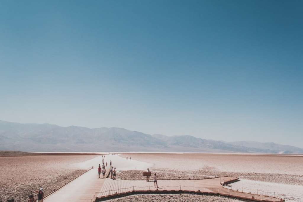
Badwater Basin Salt Flats Trail
Distance: 3.1km • Duration: 30 mins • Elevation: 2m • Map
Only got time for one Death Valley hike? Make it the Badwater Basin Salt Flats Trail. This is a relatively easy walk across pure white salt flats that are the result of centuries of erosion and geological activity. As you walk across the flats, prepare to be surrounded by a mesmerising landscape of jagged peaks and salt formations.
The trail starts at the Badwater Basin parking lot – from here, you can explore the flats at your own pace. But be warned: the trail is extremely popular as it’s the lowest point in North America, at 282 feet below sea level.
Don’t be fooled by its relatively easy terrain; you should come prepared with plenty of water and sunscreen. This is because temperatures in the area can soar to over 100°F (around 37°C). We also recommend starting your hike early in the morning to avoid the peak crowds.
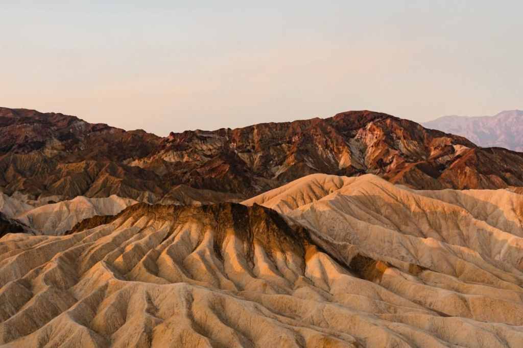
Zabriskie Point
Distance: 0.6km • Duration: 10 mins • Elevation: 16m • Map
The trail to Zabriskie Point is another beginner-friendly Death Valley hike we wholeheartedly recommend.
The trailhead is easily accessible from the main road, while the hike itself is very short. But don’t underestimate the reward; the trail leads to a beautiful viewpoint that overlooks golden badlands and eroded rock formations.
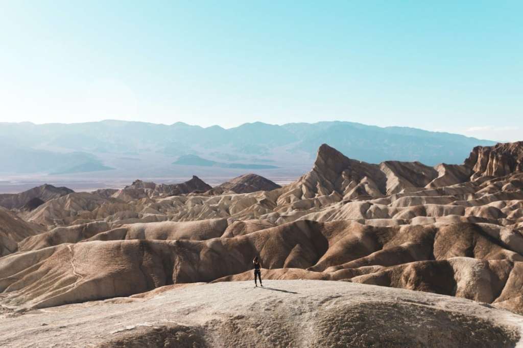
The landscape is truly otherworldly, with winding ridges that seem to stretch on endlessly. This trail is especially popular at sunrise and sunset when the rocks and canyons are bathed in soft, warm light – it’s a truly magical experience.
The best part? The trail is also accessible by car, so even those who don’t want to hike (we’ve all been there, don’t worry) can still enjoy the views.
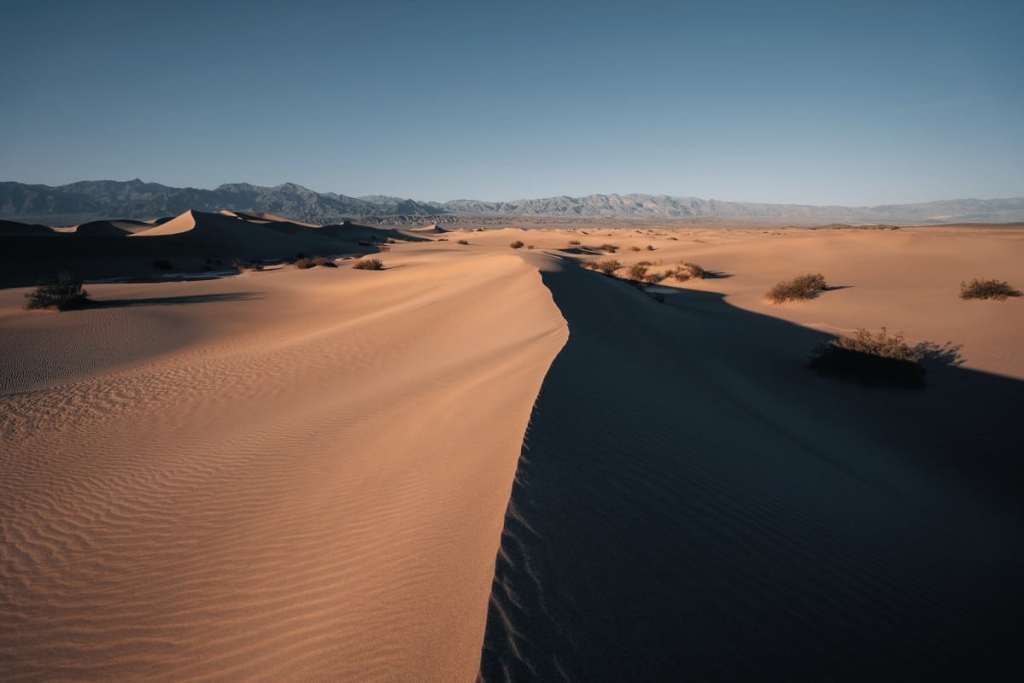
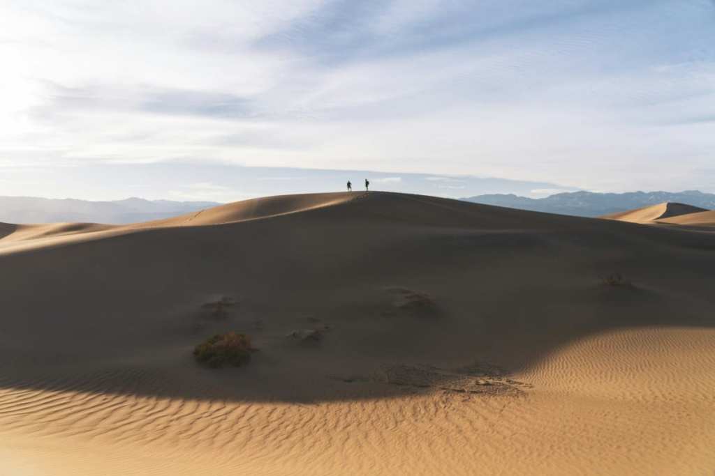
Panamint Dunes Trail
Distance: 11.1km • Duration: 3 hours • Elevation: 262m • Map
When it comes to the best Death Valley National Park hikes, the Panamint Dunes Trail is certainly up there. This striking hike takes you through a unique landscape of towering sand dunes.
The dunes tower over 500 feet high and stretch for miles in all directions – a pretty humbling sight, we think. But what’s extra fascinating about this region is that the sand is constantly shifting and changing, creating an ever-changing trail that is unlike any other in the park.
We’ll warn you – hiking on sand is exhausting AF. It’s well-worth persevering, though. The views from the top of the dunes are breathtaking, with sweeping vistas of the surrounding mountains and desert. You’ll be glad to hear that the trail itself is relatively easy to navigate, with a well-marked route through the dunes.
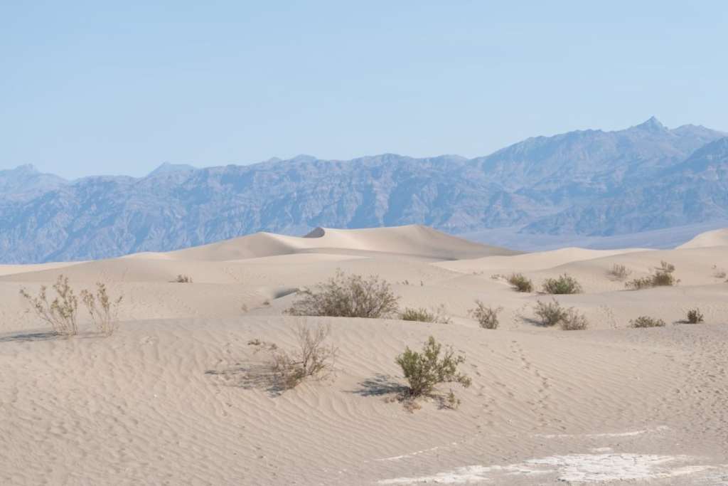
Mesquite Flat Sand Dunes Trail
Distance: 3.7km • Duration: 50 mins • Elevation: 47m • Map
One of the most famous hikes in Death Valley is the Mesquite Flat Sand Dunes Trail. It’s pretty easy, and you’ll find the trailhead near Stovepipe Wells.
We recommend hiking all the way up to the highest dune for spectacular views of the surrounding mountains and the vast expanse of sand dunes stretching out below. The trail itself is relatively easy to navigate, but you need to stay on the designated paths to avoid damaging the fragile desert ecosystem.
A word of warning from us: the best time to visit is early in the morning or late in the afternoon when the light is softer and the temperature is cooler. The sand can be scorching hot during the day, so be sure to wear closed-toe shoes and bring plenty of water.
Natural Bridge Trail
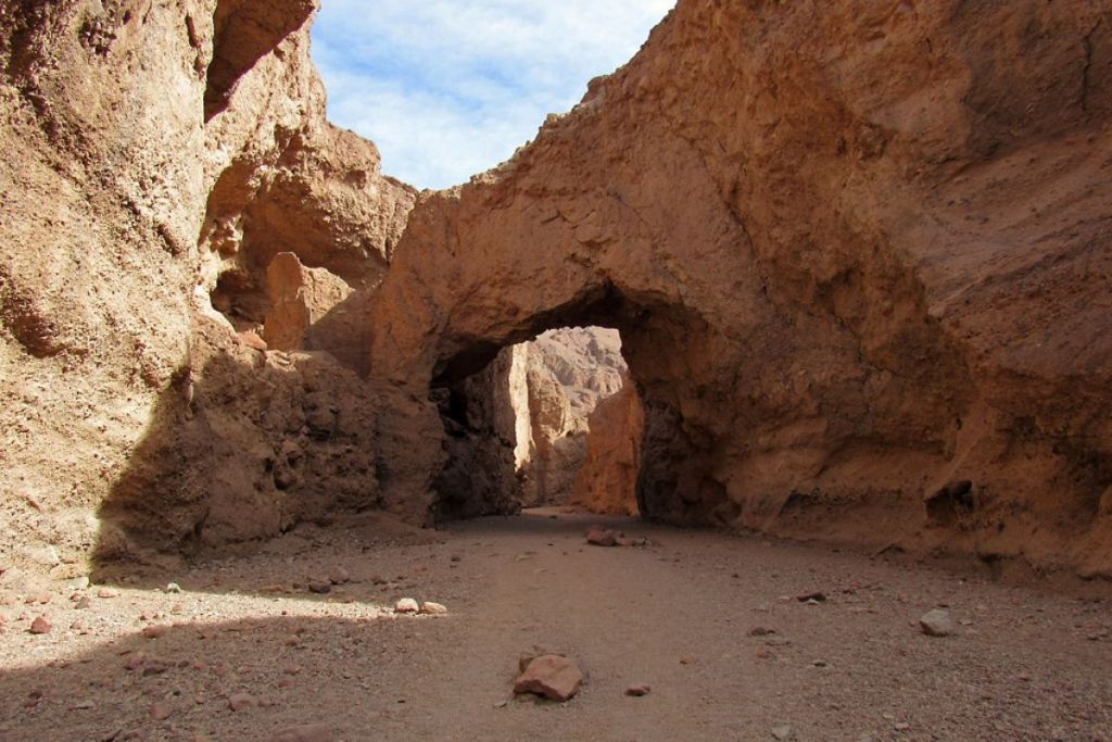
Distance: 2.3km • Duration: 50 mins • Elevation: 137m • Map
The Natural Bridge Trail is a wonderful option for hikers and nature-lovers alike. In other words, it most definitely needs to be on your Death Valley itinerary. Along the way, you’ll encounter a diverse landscape with various desert plants and funky rock formations, leading up to a magnificent natural bridge made of eroded rock.
The bridge is approximately 50 feet high and stretches over a dry creek bed. Seeing the natural bridge in all its glory is worth the (minimal) effort of the trek. It’s a perfect spot for photography, especially during the golden hour when the bridge’s colours stand out even more against the stark desert landscape.
Dante’s View Trail
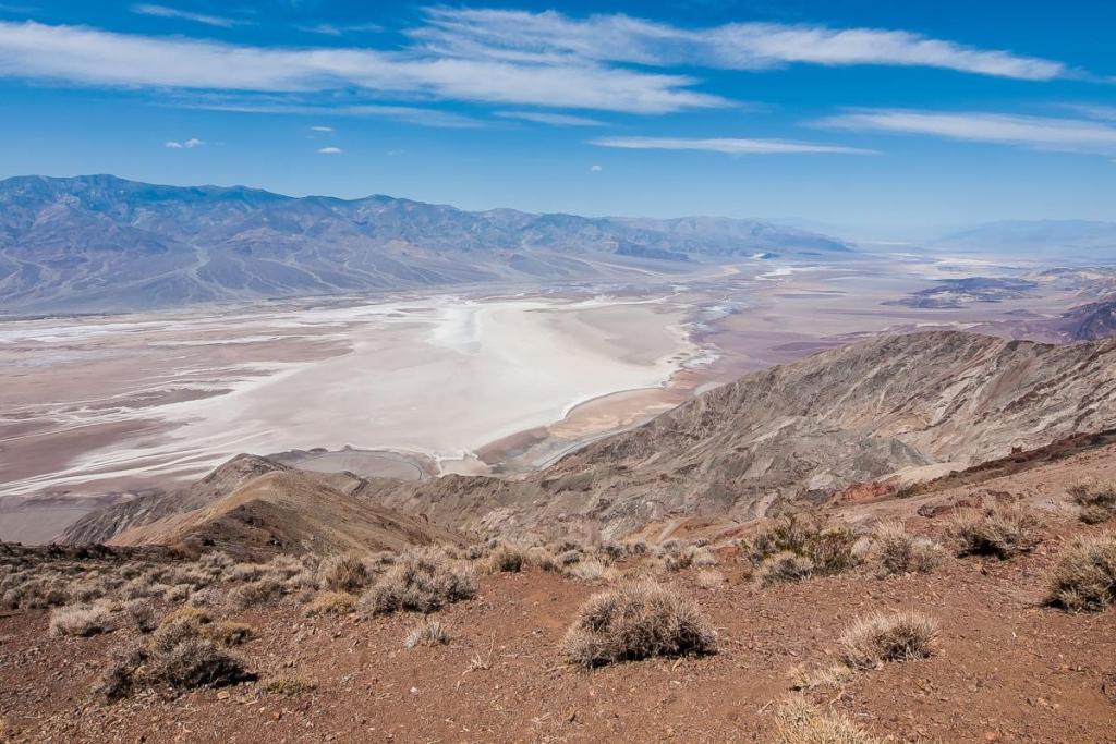
Distance: 1.6km • Duration: 30 mins • Elevation: 67m • Map
Next up, one of our favourite Death Valley National Park hikes. This trail takes you up to the top of Dante’s Peak – over 5,000 feet in elevation – providing unparalleled views of the valley below. The hike itself isn’t too challenging; well worth the magical views you’ll face along the way.
At the peak, you’ll find a small observation platform where you can take in the views and snap some pretty incredible photos. Whether you’re a nature lover, an avid photographer, or just looking for a unique adventure, Dante’s View Trail is not to be missed when visiting Death Valley.
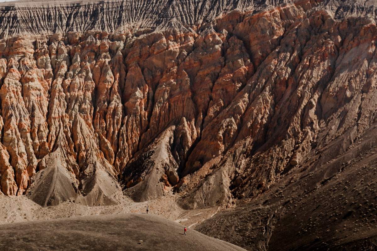
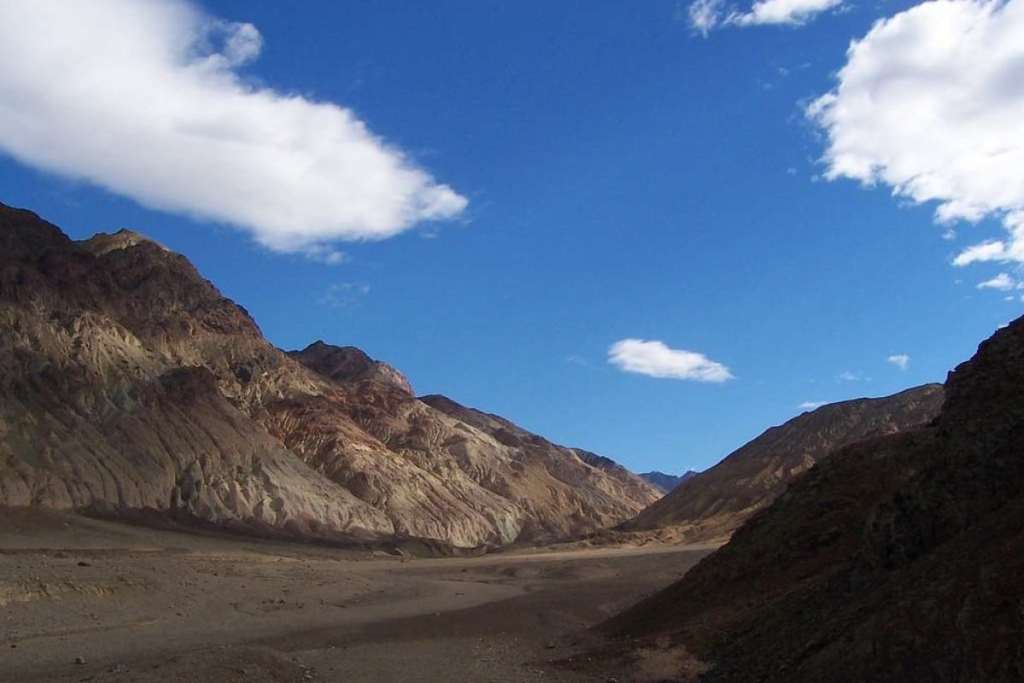
Gower Gulch Loop Trail
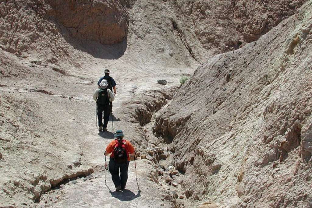
Distance: 6.6km • Duration: 2 hours • Elevation: 214m • Map
The Gower Gulch Loop Trail is another of the best Death Valley hikes. It’s ideal if you’re staying in Furnace Creek, as that’s where the trailhead is located. Once on the trail, you’ll immediately be immersed in the rugged beauty of the desert landscape. The trail is relatively easy, but does require some scrambling over rocks and navigating narrow passages, so bear this in mind.
One of the highlights of the Gower Gulch Loop Trail is passing through the narrow slot canyon that is only a few feet wide in some places. The colours and patterns of the rocks here are truly breathtaking, transporting you to a different world. The trail eventually loops back around to the starting point, but not before taking you through more awe-inspiring scenery.
Darwin Falls Trail
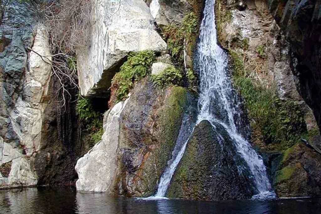
Distance: 10.8km • Duration: 2 hours 40 mins • Elevation: 205m • Map
Shhh – we think that this next hike is a little bit of a hidden gem. The Darwin Falls Trail via Old Toll Road is an easy trail that takes you through the desert towards a picturesque (but pretty small) waterfall cascading into a refreshing pool. This is a very welcome respite from the desert heat.
To start this hike, you’ll want to head to the Panamint Springs Resort – the path is relatively flat, with just a few small hills and rocky sections along the way. As you approach the oasis, keep your ears peeled for the sound of running water and get ready to feel the temperature drop as you enter a small canyon.
This trail is an excellent option for hikers of all levels but is particularly popular with families due to the ease of the hike and the opportunity to swim in the pool below the waterfall. Though, you should be aware that the pool isn’t always safe for swimming, especially after heavy rainfall.
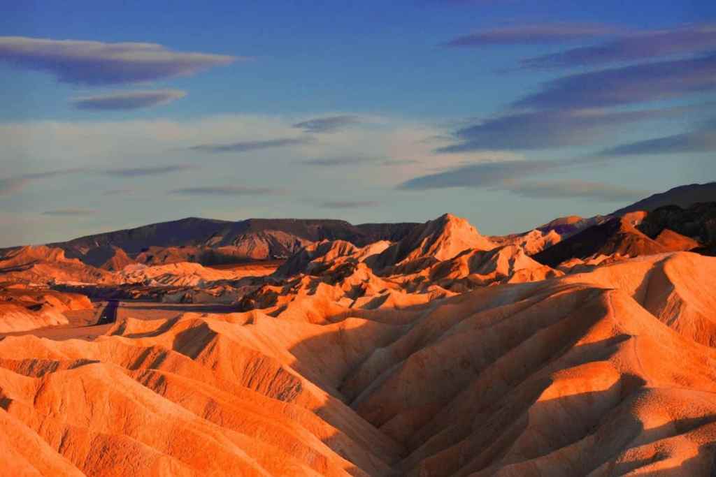
Artist’s Palette
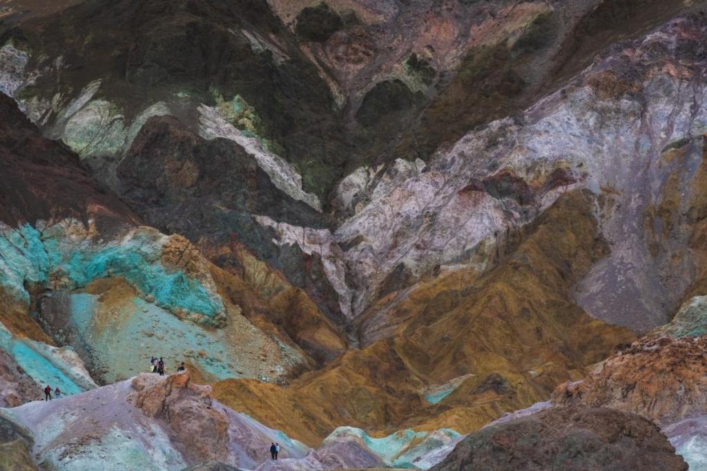
Distance: 0.6km • Duration: 15 mins • Elevation: 36m • Map
Another brilliant short hike in Death Valley is the Artist’s Palette – this is a must-see destination that can be accessed via a very easy path from the parking lot.
What exactly is Artist’s Palette? It’s a unique geological formation that features a range of hues, from deep reds and oranges to bright greens and purples. The colours are the result of mineral deposits, and they change depending on the time of day and lighting conditions.
This hike truly is short but sweet, taking you past natural mineral pigments and rock formations that will leave you in awe. Better yet, this is another Death Valley hike that is situated near Furnace Creek. It’s well-marked, making it super easy to find, while the hike is simple with just a slight incline as you make your way up to the viewpoint.
Ubehebe and Little Hebe Crater Trail
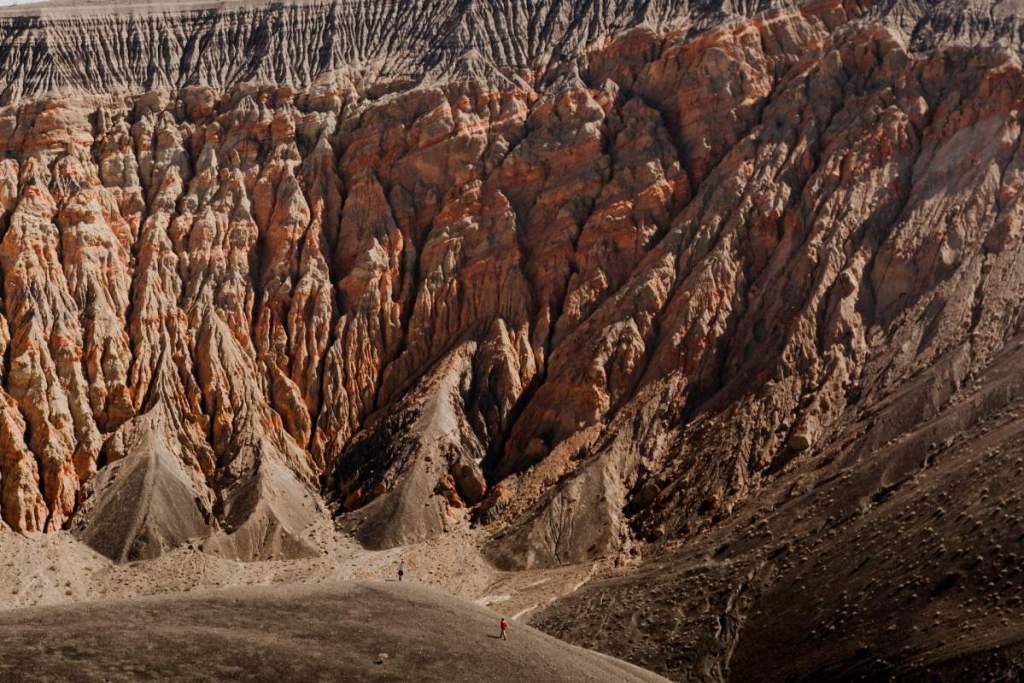
Distance: 2.9km • Duration: 1 hours • Elevation: 109m • Map
Looking for a shorter trail with a huge payoff? The Ubehebe and Little Hebe Crater Trail is ideal. The trailhead is located near the Ubehebe Crater – a massive volcanic crater that is more than half a mile wide and over 500 feet deep.
The trail starts at the edge of the crater and takes you along the rim before descending into the Little Hebe Crater, which is a smaller – but no less impressive – crater. As you descend into the Little Hebe Crater, you’ll see firsthand the unique geological formations that are created by volcanic activity.
The trail is relatively easy, with a moderate incline as you climb back up from the Little Hebe Crater to the rim of the Ubehebe Crater. Along the way, you’ll have the opportunity to explore the unique geological formations and learn about the history of volcanic activity in the area.
Telescope Peak Hike
Distance: 19.6km • Duration: 7 hours • Elevation: 989m • Map
Fancy a challenge? Telescope Peak is one of the most difficult Death Valley hikes. This near-20km trail leads you to the highest point in the park.
The trailhead is located near the Mahogany Flat Campground and is accessed via a steep and winding road. The trail starts off easy, with a gradual incline that takes you through a forest of pinyon and juniper trees. Don’t let this fool you – as you make your way higher, the trail becomes steeper and more challenging, with switchbacks and rocky terrain.
Throughout the hike, you’ll be able to marvel at the forested slopes of the lower elevations to the rocky alpine tundra of the higher elevations. You’ll also see evidence of the geological forces that shaped the area, such as exposed rocks and ancient glaciers.
The final push to the summit is steep and challenging, with loose rocks and uneven terrain. But once you reach the top, you’ll be rewarded with expansive views. And, on a clear day, you can see as far as the Sierra Nevada mountains – over 100 miles away!
Sidewinder Canyon
Distance: 6.4km • Duration: 4 hours • Elevation: 317m • Map
If you’re ready to take on something a little bit more challenging, the Sidewinder Canyon is a tricky Death Valley hike through a narrow and steep canyon. And we think it fits the bill perfectly.
The trailhead is located off a dirt road near the Mesquite Flat Sand Dunes (you could easily combine both hikes), and starts with a moderate climb. As you make your way deeper into the canyon, the trail becomes steeper and more challenging, with boulders and narrow passages to navigate. Still, this hike is manageable for most people with a reasonable level of fitness.
The rock formations create a rather dramatic backdrop to the hike; you’ll also be able to see evidence of the geological forces that shaped the canyon, such as fault lines and ancient lake beds.
Desolation Canyon Trail
Distance: 5.8km • Duration: 1 hour 50 mins • Elevation: 240m • Map
Looking for one of the coolest Death Valley hikes? We’ve found it – the Desolation Canyon Trail is a memorable hike that takes you through one of the park’s most secluded canyons. Starting from Mahogany Flat Campground, you’ll be treated to epic views of mountains and desert landscapes.
What makes this trail particularly unique is the sense of isolation and solitude you’ll experience as you hike through the narrow canyon. The trail follows a dry wash that winds its way through the rugged terrain, with towering walls of rock on either side.
Venture deeper into the canyon, and the walls become even more dramatic and imposing. But that’s not all – along the way, you’ll also encounter evidence of the area’s mining history, such as old mining roads and equipment. The trail itself is relatively simple to navigate, with only a few moderate inclines and some rocky terrain.
What to know before you tackle these Death Valley hikes
When visiting Death Valley, there are three main hubs near the park: Furnace Creek, Stovepipe Wells Village, and Panamint Springs. The vast majority of people choose to stay in Furnace Creek (where the visitor centre is), though you can pick up gas and food at any of these spots.
It goes without saying that you should remember to bring food with you and make sure you have plenty of water when out on these hikes. Death Valley gets ridiculously hot, especially in the summer months.
What time of year is best to hike Death Valley?
If you’re wondering when to plan your Death Valley trip, take our advice and head there in spring. Why? The heat isn’t as intense and you might just spot some wildflowers. You can thank us later.
What is the highest hike in Death Valley?
If you want to tackle the highest climb in Death Valley, you’ll want to head out on the Telescope Peak trail. Expect epic views of Death Valley’s otherworldly landscape below.
